

Oxford boundary markers: King’s Mill House, New Marston (1843)

[City coat of arms
showing ox crossing ford]
J. W Y A T T
M A Y O R
W A R B U R T O N
S H E R I F F
1 8 4 3
Outside King’s Mill House, Marston,
at the entrance to Mesopotamia.
It marked the Ward and Union boundary, but may have been moved from further east: see below.
James Wyatt was Mayor in 1842/3,
and George Warburton was Sheriff
Not a listed structure
Back to list of Oxford
boundary stones
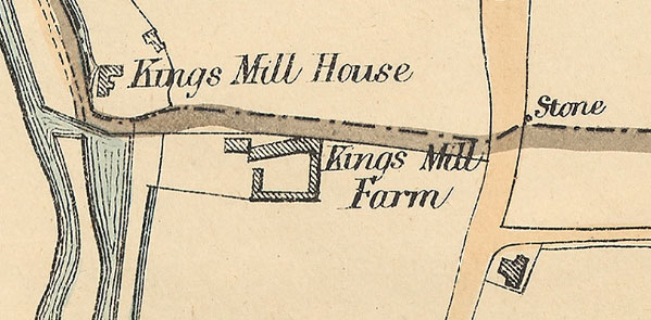
Right: Extract from a map of 1883 produced for the Local Board showing the boundary of Oxford and the stones that marked it.
It marks a boundary stone on the opposite side of the Marston Road to Kings Mill Lane, to the north of Cuckoo Lane. As this stone is no longer there and the map shows no stone at Kings Mill House, it seems likely that it may have been moved to the house from the Marston Road when it became redundant after the boundary changes of 1889