

Oxford boundary markers: Marston Meadows 1 (1841)
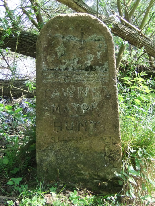
[City coat of arms showing
ox crossing ford]
———
T A W N E Y
M A Y O R
———
H U N T
S H E R I F F
———
Boundary stone on private land in Marston Meadows, marking the boundary between Oxford and Marston.
Not a listed structure
Charles Tawney served his second term as Mayor of Oxford in 1840/1, with Hunt as Sheriff. This stone unusually appears to have been set up during his mayoralty rather than in preparation for an official perambulation. (This now took place triennially, and had been duly undertaken by Tawney's immediate predecessor Thomas Mallam in 1840, and the next one would be by Thomas Wyatt in 1843.)
Back to list of Oxford
boundary stones
John Gilbert wrote in 1886: “The west side of the ditch must be traversed as far as to where it rejoins the Cherwell just below Parson's Pleasure bathing place. In a field on the right, on the river bank, is the last stone on the circuit, No. 30 (marked as No. 28). The Municipal boundary now keeps to the centre of the Mill head as it runs along the east side of Mesopotamia Walk, finishing its course at King's Mill.”
This is probably the same boundary stone as the one photographed here by Henry Taunt in 1884 and described as being in Mesopotamia (Historic England CC73/00405):