War Department stones in Oxford
This type of Ordnance Survey Marker is marked WD (War Department), with the the department's broad arrow pointing upwards between those two letters. They mark the boundaries of land owned (or formerly owned) by the War Department.
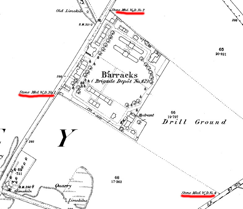
In Oxford four War Department stones marked the corners of Cowley Barracks, and they are shown on the map below, which dates from 1878. Three of the stones survive today.
W D No. 1 |
W D No. 2 |
W D No. 3 |
W D No. 4 This stone marking the back right corner of the barracks land
The following additional information on later War Department stones installed since the 1920s was kindly supplied by Ian Meadows Marker stones were only erected at the First World War stations/camps that became permanent bases after that war. Most were erected between 1926 and 1929 and were the result of the decision made by the Salisbury Committee that the Air Ministry/War Department should own the land on which their buildings stood instead of only the buildings as in the case of WWI. These stones were erected where there is a change in direction of boundary. There were at least two types, a large one and a smaller version. Each one has a unique number to that station and around 20 or more were erected at each site. The post-war Royal Observer Corps stones follow the same principle as their 1920s counterpart but do not appear to be numbered. |
Map of 1878 showing Cowley BarracksThis map shows that the War Department stones marking the corners of Cowley Barracks were already in place by 1878.
Map of c.1899 showing all four boundary stonesAll four boundary stones (B.S.) can be seen on this National Library of Scotland map of c.1899 (close obstructive boxes) Side-by-side maps of the area covered by the barracks in c.1899 and todayThe stone are marked B.S W↑No. 1 and B.S W↑No. 2, and then B.S W↑B (curiously with no number) and B.S W↑No. 4. |
|
|
|
|