

Oxford boundary markers: Old Abingdon Road (probably 1892)
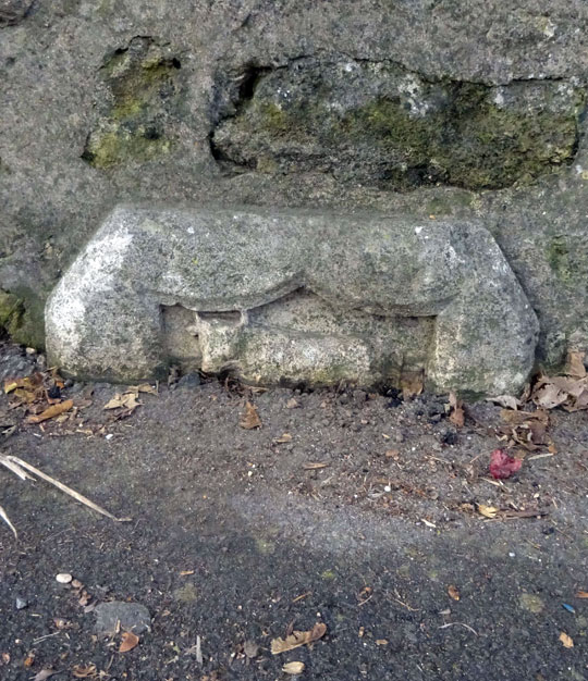
Photograph kindly supplied by Mr Red & the Milestone Society
This map shows the new 1889 boundary of the city marked in blue.
1899 map with this boundary marker in the middle
marked B.M.
side-by-side with modern map
[City coat of arms showing
ox crossing ford]
The rest of the stone is buried
under tarmac, but is likely to say:
1 8 9 2
F. W. A N S E L L
M A Y O R
W. S. C A R V E R
S H E R I F F
This stone is set gainst the Northern parapet of the bridge over the Hinksey Stream towards the north-east end, marking the Oxford City boundary.
The top of the shield and the ox on this stone is similar in style to this one on the Godstow Road bridge, and so it almost certainly belongs to the following series of boundary stones that were set up at the time of the Mayor's perambulation of 1892 (the first such inspection to take place after the 1889 Oxford boundary change):
- Opposite Headley Way
- Woodlands Road
- Canal towpath
- Woodstock Road
- Sunnymead
- Iffley Meadows
- Hogacre Common
- Port Meadow (probably)
- Godstow Road bridge
Frederick Ansell was Mayor of Oxford in 1891/2, and there was a special perambulation that year.
William Stevens Carver (1859–1917), the Sheriff of Oxford who would also have been named on this stone, was at the time of the 1891 census a 32-year-old accountant & auditor who lived at 7 Longworth Road with his wife Eliza and their three young daughters. He was the City Accountant from 1894 until his death (obituary in the Oxford Journal Illustrated of 26 December 1917, p. 9).