

The West Gate and its Church
The West Gate
The West Gate of Oxford stood just to the south of the Castle, and is marked on Agas's 1578 map of Oxford (which has south at the top) just to the west of Pennyfarthing Street:
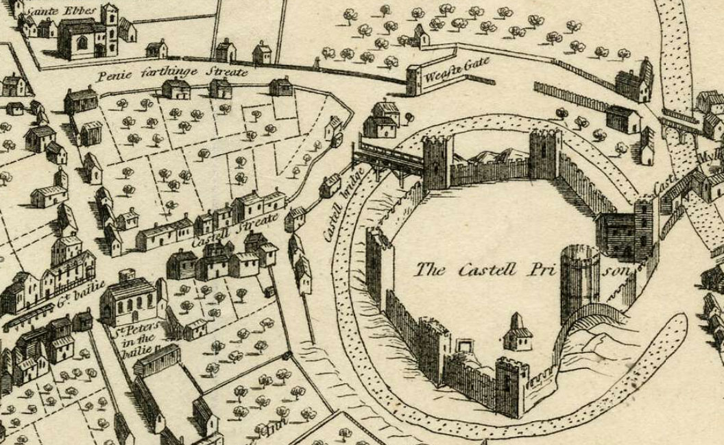
The West Gate fell down or was demolished in the mid seventeenth century, but the name lives on in the name now given to the whole area.
St Peter-le-Bailey Church
This medieval church stood at the present Bonn Square, a short distance away from the gate that it guarded, and can be seen marked “St Peter's in the Bailie” towards the bottom left of the above map. That church fell down in 1726. It was rebuilt on the same site, and the engraving below, looking east along Queen Street, shows it in 1835:

Then in 1874 the second church shown above was also demolished as part of a road-widening scheme. It was rebuilt further up New Inn Hall Street and is now the Chapel of St Peter's College. In 2008 its former churchyard was paved over to create the new Bonn Square.
It was also known as St Peter-in-the-West or St Peter-at-the-Castle (a bailey being a castle's outer wall).
The OS map of 1876 (below) shows the site of the first and second St Peter-le-Bailey Churches, at the front of what is now Bonn Square and near the Westgate Centre.

The map below of 1850 shows the shape of the second church more clearly:

Victoria County History: History of the County of Oxford, Vol. IV
St Peter-le-Bailey Church

From the West Gate, the wall continued a short distance north-west to meet the bailey or outer wall of the Castle, where the tour began.
See also:
- Victoria County History: History of the County of Oxford, Vol. IV, pp. 300–304:
[Oxford’s] City Walls, Gates, and Posterns
For another virtual tour of the city walls with some fine photographs, see this blog by the Oxford Sausage:
“Walking the Walls”
Oxford Archaeology (for the Oxford Preservation Trust):
Oxford City Walls walk guide
