

How to research an Oxford street
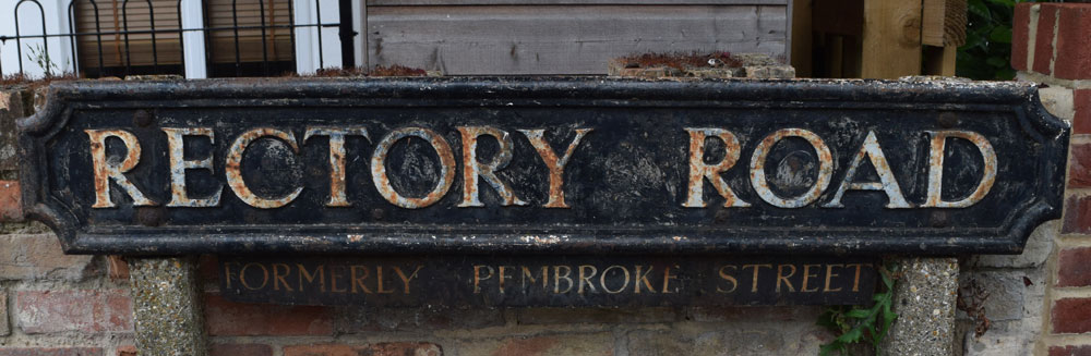
Tracing the history of a street is like tracing a family tree: the only sure way is to work is backwards from the known to the unknown. This way, you will soon see if any of the street names or house numbers have changed over the years.
You need to watch out for the following five pitfalls in Oxford:
Suburbs that were villages
The present-day suburbs of Headington, Cowley, Iffley, New Marston, Summertown, and Wolvercote were not part of Oxford until 1929, so do not expect to find them listed under Oxford in directories until 1930 (and even St Clement’s did not become part of Oxford until 1835). This means that prior to Kelly's Directory of 1930, some of the houses in a long road can be in the city and the ones further away in a village: for instance, the houses on the Woodstock Road up to the present 247 on the south side of Bainton Road were in the city, but north of that they are listed under the village of Wolvercote (with Wolvercote starting on the east side at No.320).
Prior to 1930, these former villages are listed alphabetically at the back of Kelly's Directories for the city in the “Neighbourhood of Oxford” section, but are not dealt with as thoroughly as the city streets, partly because the houses in villages were not usually numbered. And beware of Cowley, which does not come under C, but T (for “Temple, Middle, and Church Cowley”).
Littlemore, Old Marston, and Risinghurst & Sandhills were not taken into the city of Oxford until 1991, so they remain at the back of Kelly's Directory right up to the last edition in 1976.
Parts of the present-day Oxford were in Berkshire
Oxford south of Folly Bridge, and parts to the west including Binsey, were not even in the same county, and will be found under Berkshire. The birth of children in these parts of Oxford was registered in the Abingdon registration district, and some older records will be at the Royal Berkshire Archives.
Some areas that have always been in Oxford will not be found under the Oxford Registration District
Some parts of Oxford such as the parishes of St John the Baptist in Merton Street and St Giles, as well as suburbs such as Summertown, Cowley, Headington, and Iffley, were in the Headington Registration district until 1930. Beware of saying that the occupants of your house were born in Headington just because their birth was registered in that district: it will probably be wrong.
Many Oxford streets have been renamed
Many streets, particularly in the suburbs were renamed, as each former village had a High Street and Church Street of its own, and duplication of names in the city was eventually removed. So in Summertown, for example, look for Albert Road (not Hobson Road); Church Street (not Rogers Street); and George Street (not Middle Way). Much of the renaming, though, did not take place until the 1950s.
See for example this street plan of east Oxford near The Plain in 1876 showing Black Horse Yard (now Dawson Street) and William Street (now Tyndale Road). Most long roads were not properly numbered and this plan shows groups of houses on the Iffley Road named as Portland Terrace, Grove Villas, Magdalen Terrace, and Isis Villas, and on the Cowley Road named as Milton Cottages, Circus Terrace, and Havelock Terrace..
Many roads were renumbered (some more than once)
Some streets were renumbered at much as three times in the twentieth century as they became more developed: this is particular true of long roads such as the Woodstock, Banbury, Headington, and London Roads. Even streets which appear to have the same numbering system as they did in the 1840s have anomalies where the layout of buildings has been rejigged. The following link explains how the street-numbering system changed over the years:
Not all houses in a street will be in the same parish
The censuses are done by parish, not street, and many Oxford streets straddled more than one parish, meaning that you will have to look for it in more than one census book. Cornmarket, for example, is in two parishes, and perhaps more surprisingly St Giles' Street isn't all in St Giles's parish. Oxford's High Street being very long straddles four parishes and appears in four census books up to 1891, then three. Broad Street is split in a different way, with the houses on the north side coming under one parish and those on the south side under the other, with the added complication that it then also had an east side (the top end down to New College Lane, now mostly regarded to be part of Catte Street) in two other parishes (St Peter-in-the-East and Holywell).
Sources viewable without a subscription from your own computer at home
Some of these links provide all the information you need on screen; but even those that only give an index can be helpful. You will, however, have to visit a library to view the street censuses on Ancestry and FindMyPast free of charge: see next section.
- Historical Directories
The most important thing to do when starting to research a street is to get hold of old street directories, and although you will eventually need to use each year's Oxford directory in the Oxfordshire History Centre, printing off your street in the years available in the link above could give you a start. Some Oxfordshire directories are available free on the University of Leicester Historical Directories website: it is quite hard to find the page you want, though, and the screen pages do not correspond to the book pages. With Kelly's Directory for 1895, it may be useful to know that if you type in 229 (out of 458) in the box at the top you will land right in the middle of the streets of Oxford.
(If you have a subscription to Ancestry you will find a limited number of directories here, but for a complete set you have to visit the Oxfordshire History Centre.) - Oxfordshire Heritage search
This includes the Oxfordshire History Centre Business and People indexes (the names of Oxfordshire businesses and people compiled from local newspapers 1800–2006). It also includes Picture Oxon, but if you only want images, you can search separately here - Oxfordshire Heritage Search mapping platform (with mapping guide here)
- Oxfordshire History Centre map collections
- Historic England photographs
This includes many Oxford images, which can be embedded on a non-commercial website free of charge - Jackson’s Oxford Journal name index 1791–1800 (PDF)
- Jackson’s Oxford Journal place index 1791–1800 (PDF)
- Oxford Journal Illustrated photo index 1909–1928 (PDF)
Sometimes the brief description is enough, and you do not need to look the article up on microfilm - Oxfordshire sales catalogues 1982–2006
- Oxfordshire Buildings Index (PDF)
- “Domesday Survey”: District valuation records of property throughout the historic county of Oxfordshire (1910–1915)
- Downloadable Oxfordshire Family History Society maps showing parish boundaries in c.1900:
Oxford city and Oxfordshire
(compare with this eleventh-century map with the parishes marked) - Old Maps Online
Search for your street and a modern map comes up. You can zoom in on the area if you are interested in if you wish. Then click the square with the diagonal arrow under the plus and minus sign, and draw a rectangle over the area that interests you. You will then be presented with a series of old maps for the area running down the right-hand side - National Library of Scotland maps
Includes detailed maps of Oxfordshire, and you can overlay modern maps on the old ones or view them side by side and capture the link - Ordnance Survey 1876 Town Plan of Oxford
This shows every single building but does not including present suburbs such as Headington and Cowley that were then villages outside Oxford.
Oxfordshire History Centre version: Click on the square you want, zoom in, and make it full-screen. You can then click on the magnifying glass with the + sign at the top and make it even larger.
National Library of Scotland version: This is not as sharp, but has the advantage that the whole Town Plan is in one piece which you can drag to the area you want, and it is also possible to see it side-by-side with a modern map - Britain from Above
Aerial views of most of Oxford and beyond are available via the Search function. You can see them without logging in, but if you do register you can zoom in on the photographs and get more detail, see the markers that people have added, and add markers of your own
Browse all 412 pages of Oxford images here - Oxoniensia
This online journal on the architecture, archaeology, and history of Oxford and Oxfordshire has a search function, so it is well worth taking a look - British History Online search page
- Victoria County Histories of Oxfordshire and of Berkshire
For the present city of Oxford, obviously look at Volume 4 (the City of Oxford) of the Victoria County History of Oxfordshire, but also see Volume 5 (Bullingdon Hundred) for villages like Cowley, Headington, and Iffley prior to 1929 that are now suburbs of Oxford.
Also remember that some parts of Oxford and Oxfordshire were once in Berkshire (such the Abingdon area, North & South Hinksey, Cumnor, Seacourt, and Wytham): for these see Vol. 4 of the Victoria County History of Berkshire - Oxfordshire County Council: reference online at home
If you have your Oxfordshire County Council library card number to hand, you can log into the Oxford Dictionary of National Biography and Who's Who (including Who Was Who) at home.
Since 1 January 2025 it has not been possible to view Jackson's Oxford Journal or The Times Digital Archive at home, but they can be viewed in libraries via the British Newspaper Archive. . - Oxford Mail searchable archive
This can be very useful for recent news about a building, as although it only goes back to 1998 it can solve some more recent mysteries. - Oxfordshire Record Society
Many of their published volumes can be downloaded free here - Free BMD
This charity run by volunteers indexes all births, marriages, and deaths in the UK between 1837 and 1983 (but the later entries are not yet complete). This is useful for determining when people moved in and out of registration districts. Obviously former villages to the east such as Headington, Cowley, Iffley, and Littlemore were in the Headington registration district, but note that areas such as St Clement's, east Oxford, Merton Street, north Oxford and Summertown were also included under Headington, so it is always safer to search two districts at once, Headington and Oxford, when looking for Oxford people. Even some people who definitely lived in the Oxford registration district died in the Radcliffe Infirmary, so their deaths would have been registered in the Headington one. - National Heritage List for England (NHLE)
Search for listed buildings here. - Inventory of the Historical Monuments in the City of Oxford, secular buildings section (published by His Majesty's Stationery Office, London, 1939).
- Historic England photographs
There are many photographs of Oxford on this site - Planning applications online
The Town & Country Planning Act of 1947 that came into effect on 1 July 1948 meant that thereafter planning permission had to be sought for any new development. Oxford City Council’s planning applications site is surprisingly useful for understanding what happened to buildings in the second half of the twentieth century, and it fills the gap between the last Kelly’s Directory in 1976 and the present. It can also reveal when newer streets were first laid out. And if the house you are interested in is a listed building, any planning application is likely to be accompanied by a heritage statement giving the history of the building (see for example “Heritage statement vol 1” under the Documents tab of application 23/00563/LBC relating to 71 & 72 High Street, produced for Magdalen College by Oxford Archaeology) - Oxfordshire Wills
There is information on Oxfordshire wills here. The wills and related documents proved by the Archdeaconry of Oxford or one of the Peculiar Courts in the county are held at the Oxfordshire History Centre and can be accessed via FindMyPast.
Transcriptions of Oxfordshire Wills of any kind made by members of the Oxfordshire Family History Society can be found here for everyone to use, and as the number is growing by the week this is becoming an extremely useful resource.. - Prerogative Court at Canterbury (PCC) wills
Prior to 12 January 1858, wills in England and Wales were proved in ecclesiastical courts. The largest one was the Prerogative Court of Canterbury, 1384–1858, and those wills are available from the National Archives (see next), and are also on Ancestry (free in many public libraries). - National Archives Discovery
Here you can find and index to useful documents such as PCC Wills. Sometimes you can get the basic information you need just by looking at the index, and currently PCC wills are free as long as you register with them for a free account. - Old postcards
A quick search on eBay for "postcards cowley oxfordshire" etc will almost always bring up some postcards you have never seen before. Save the search to get new items emailed to you automatically - Oxfordshire Parish Registers
Lists compiled by the Oxfordshire Family History Society: Oxford city and Oxfordshire. They have scanned many of these registers and they are now available on Ancestry

Identifying the date of old postcards that show your street
Many postcards can be dated online via the serial number that bigger manufacturers printed on either the front or the back of the card, e.g.:
Dating professional photographs
If you have a photograph showing your street that you want to date and it is not catalogued in the Picture Oxon archive, if it has the name and address of the photographer you can narrow down the time-range by downloading the Picture Oxon PDF lists of Oxford and Oxfordshire photographers.
Google Streetview
StreetView on GoogleMaps in some cases goes back as far as 2008 and already can be useful for establishing the recent history of a building, Drag the image of the little yellow man (bottom right) to roughly on the street where you want to be then swivel image with mouse if necessary and click on arrows to move about. When you have the view you want, click on “See more dates” at top left and open the one you need.
Insurance policies
Better-off Oxford people usually insured their homes and businesses. The nationwide records for insurance companies whose offices were based in London are held in the London Metropolitan Archives, and volunteers have recently indexed over 380,000 Sun Insurance policies from the eighteenth century onwards. You can search for them here online: https://search.lma.gov.uk/
If you put "oxford insured" in that search box you will get 5,195 results: some of these will refer to Oxford Street in London etc, but it is a certain way of not missing any results through strange spellings or unusual variants of street names. Whatever you put in the search box, the crucial word to add is insured.
Oxfordshire History Centre
www.oxfordshire.gov.uk/oxfordshirehistory
This research centre in Cowley combines the former Oxfordshire Record Office and Centre for Oxfordshire Studies. It has restricted opening times and sometimes unexpected closures, so check here before visiting that it is open.
If you want to look at original sources (as opposed to books and material on screen) you will need to apply in advance for an Archives card: full instructions here.
They have both primary and secondary sources, including:
- Maps
There are Ordnance Survey maps from 1876 to 1939 detailed enough to show every building in Oxford. Enclosure award maps are also extremely useful, as many streets still follow the lines of the awards. These can be viewed on screen - Street directories, including Kelly’s
If you are doing a detailed history of a street, It is advisable to photocopy the street from every available directory published since the street was numbered (namely 1839 to 1976). (Photocopying a directory for every five or ten years just doesn’t work; but of course you can avoid all this photocopying if you are able to do all your work at the Centre.) There are also earlier directories that include Oxford from 1841 in the county directory section where you will find the houses listed alphabetically under the inhabitants, and with house numbers. Before the penny post in 1840, very few streets were numbered; and villages such as Headington and Cowley that later became suburbs were not properly numbered until 1930.
List of all street directories of Oxford and the County held in the Oxfordshire History Centre (PDF) - Censuses
FindMyPast and Ancestry are available free on computers at the Oxfordshire History Centre (also at the central library).This includes the censuses of 1841, 1851, 1861, 1871, 1881, 1891, 1901, and 1911, plus 1921 on FindMyPast only, and the 1939 Register - Telephone directories
Oxford telephone directories go back to the nineteenth century, but before the 1970s so few people had telephones that they will not necessarily be useful. But the ending of Kelly’s Directory in 1976 means that the period from 1977 to the present makes the later directories valuable if you want to check when a person or business moved away and the next one came in. (Oxford telephone directories are also available on Ancestry.) - Oxford Historical Society books
All the books published by this society are invaluable: see lists of titles here
Two books by H. E. Salter are particularly valuable and will take you painlessly back into the seventeenth century: his Survey of Oxford in 1772 gives the occupant and the measurement of the frontage of every house in the city of Oxford, taken in consequence of the Mileways Act of 1771; and his Oxford City Properties lists rental details of the numerous properties that were owned by the city up to 1855 - Newspapers
The whole of Jackson’s Oxford Journal is available on microfilm with a bound index for the years 1753 to 1790 (and see above for online indexes from 1791 to 1800). The online version of Jackson's Oxford Journal dates from 1800 to 1900 only, and was produced from the British Library set which is missing some newspapers, especially in the 1890s. You can see the missing ones on microfilm at the Oxfordshire History Centre. - Building plans
The Oxford City Engineer’s Department Deposited Building Plans for 1875 to 1934 are available on microfiche. They list every street in Oxford and clarify which buildings were rebuilt, and when. - Parish registers
Transcripts of nearly all Oxfordshire parish registers are available both in paper format and on computers (and both are also available at the central library). Don’t expect to find a street all listed under one parish: see above - Oxfordshire wills
Often just the date of probate in the printed index book is enough to establish why and when a house changed ownership. - Alumni Oxonienses The grander houses of Oxford were often occupied by academics, and biographical information can be found in the printed volumes held in the centre. (If you subscribe to Ancestry, it is also available online there.)
- Electoral registers and title deeds
- Books with old photographs. These are too numerous to list, but are invaluable in understanding how buildings (whether surviving or not) were laid out. For shops in central Oxford, for example, see Michael L. Turner and David Vaisey, Oxford Shops and Shopping.
- Oxfordshire Health Archives
If your house had a medical connection, you will find information here.
Oxford Westgate Library
https://www.oxfordshire.gov.uk/oxfordshire-libraries/find-library/oxford-westgate-library
Most of the local history resources that used to be here are now at the Oxfordshire History Centre in Cowley, but this library has longer opening hours and can be more convenient. If you go to the top floor of the library you should find the following:
- One microfilm reader and a duplicate set of microfilm for the Oxford Journal Illustrated and the Oxford Times. It does not have Jackson's Oxford Journal 1800–1900, because it is available via the British Newspaper Archive (but you may still have to go up to Cowley for that if you need the editions in the 1890s missing from the British Library version). Hint: You don't have to pay to take photographs here, so snap the articles that interest you with your phone for transcribing later.
- A duplicate set of all the parish register transcriptions on paper made by the Oxfordshire Family History Society, and also available online
For those with an Oxfordshire library card:
- A large set of online resources including Ancestry, FindMyPast, Oxfordshire Family History births, marriage, and burials indexes, maps
- The British Newspaper Archive (including Jackson's Oxford Journal and The Times Digital Archive).
Archivists
- Oxford College archivists
If your house was built on land owned by a college, you will be able to find out more by visiting college archives.
Online Books
Google are putting more and more old books online, so it is always worth searching Googlebooks for topics that interest you. It is also well worth seeing what books are available at the Oxfordshire History Centre, and the Central Library at the Westgate has a reasonable selection of local history books that can be borrowed.
Bodleian Library
If you are a reader at the Bodleian Library, there is a large amount of material there. Even if you are not a reader, you can often find helpful information in its online catalogue.
There are also two printed books published by the Oxford Historical Society listing the Bodleian holdings of printed items such as Oxford auction catalogues. Remember that suburbs such as Cowley, Headington, and Summertown that were originally villages outside Oxford will be listed under “Individual localities” in the county volume, not the city one:
- E. H. Cordeaux & D. H. Merry, A Bibliography of Printed Works Relating to the City of Oxford (1976)
- E. H. Cordeaux & D. H. Merry, A Bibliography of Printed Works Relating to Oxfordshire (Excluding the University and City of Oxford) (1955)
House deeds
Don't forget your own house deeds, or those of your neighbours, which give useful information about the history of your house and usually reveal who originally owned the land.
Resources on Ancestry
If you subscribe to Ancestry, note that they have some Oxfordshire resources you may not have considered. For instance, they have the following directories online:
1830 Pigot´s Directory
1842 Pigot´s Directory
1847 Post Office Directory
1852 Gardner´s Directory of Oxfordshire
1864 Kelly´s Directory
1869 Kelly´s Directory
1876 Harrod´s Directory
1882-1889 Rusher´s Banbury List & Directory
1890-1896 Rusher´s Banbury List & Directory
1895 Kelly´s Directory of Oxfordshire
1903 Kelly´s Directory
1907 Kelly´s Directory
1911 Kelly´s Directory
1939 Kelly´s Directory
Also online on Ancestry are books relating to the University, such as the Brasenose College Register and Oxford Men and their Colleges 1880–1892
Malcolm Graham's “On Foot in Oxford” series
These short books give a good overview of the history of the interesting buildings in the streets of central Oxford:
1. Oxford Castle to St Giles'
Includes St Michael's Street, Cornmarket, Shoe Lane, Gloucester Street, Friars Entry,
Little Clarendon Street, Beaumont Street, Gloucester Green, Bulwarks Lane2. Broad Street
(inclues Ship Street, Cornmarket, Carfax, Covered Market, Turl Street,
Radcliffe Square, Bodleian, Catte Street3. Catte Street to Parson's Pleasure
Includes Holywell Street, Mansfield Road, University Museum and Science area,
St Cross Road, Longwell Street4. Paradise Square to Sheepwash
Includes Paradise Street, Osney Abbey, Osney Cemetery, Rewley Abbey,
Quaking Bridge, St Thomas's Street & Church, Tidmarsh Lane, Railway Station5. Carfax to Turn Again
Includes St Ebbe's Church, Pembroke Street, Brewer Street, The Friars,
St Ebbe's, Oxford Castle6. High Street to Trill Mill
Includes Carfax, High Street and roads off, Botanic Garden, Rose Lane,
Christ Church Meadow, Folly Bridge, Speedwell Street, Pembroke Street, Town Hall
Oxfordshire History Centre: House history